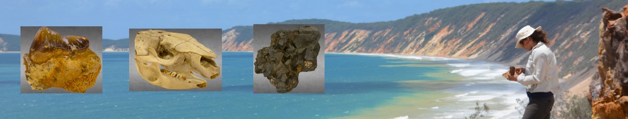
Find here information relevant to the Internal Field Trip
Below is a map of all the field sites that we have visited (purple squares) and also local Miocene age volcanic sites (red mountains).
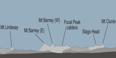
Miocene volcanoes visible from Pegg’s Lookout
From this spot we can see much of SE Queenslands’ fiery past. If you follow the Pegg’s Lookout tour images you can see many mountains and low hills on the horizon. The majority of these are in fact volcanoes.
North of Brisbane are the Glasshouse Mountains which are around 26-27Ma. Mt Beerwah is the largest of the Glasshouse Mountains and is a volcanic plug made of Trachyte.
On the image above the majority of the peaks to the East (with the exception of Spring Mountain and White Rock), are associated with the Main Range Volcano (most active around 25 Ma). The area of the main central pipe of this volcano is unknown due to extensive erosion since the Miocene, but is likely to have occurred around the township of Kalbar. The mountain chain in the distance makes up the Great Dividing Range and is comprised mostly of basalts. Notable landmarks here include Cunninghams Gap where a major highway passes through opening up to the Darling Downs in the west, an area famous for its ‘Ice Age’ megafauna (we’ll look at these in our coming lectures and pracs). The peaks that are slightly closer, such as Mt Flinders, formed in the late stage of the Main Range Volcano when magma filled various vents and plugged them. The rocks today are mostly trachyte (intermediate in composition between andesite and rhyolite).
Just to the east, you can see the remains of the Focal Peak Volcano (most active around 24 Ma), centred on Focal Peak itself. The twin-peaked Mt Barney, just to the west, formed during the later stages of the Focal Peak Volcano. The rock here is a granophyre– it has the same geochemical composition as basalt and gabbro. Similar to gabbro, it is a plutonic rock, but cools slightly faster and therefore has crystal sizes that are intermediate between that and basalt. After it cooled, it was thrust upwards and today stands higher than the Focal Peak caldera.
You are going to “visit” the eastern margin of the Tweed Volcano (most active around 22 Ma) later in this virtual field trip, that was centred over Mt Warning. The northern flanks of the volcano are still largely intact and are similar to what they looked like back in the Miocene (although the volcano would have been much taller). They are represented here by the Lamington Plateau.
Calculating the movement of The Australian Plate
Each of these volcanoes formed as the Australian tectonic plate passed over a hotspot. Although it is estimated that the plate had been moving northwards as fast as 6-7 cm / year since it split from Antarctica, it slowed down considerably from 25-22 Ma, and briefly starting moving westward, when it collided the Ontong Java Plateau (an oceanic plateau that is part of the Pacific plate, northeast of New Guinea). After 22 Ma, it sped back up and started moving northwards again.
By taking into account the age and distance between the north/ south positions of the central pipes of the these volcanoes (Beerwah, Kalbar, Focal Peak, and the Tweed Volcano) you should be able to calculate the rate of plate speed before and during the collision in cm/year.
YOU SHOULD DO THIS LATER AND ADD TO YOUR REPORT.
Download the KMZ file here and measure the distances between the volcanoes using Google Earth.